Infrastructure
Get Your Kicks: Route 66 Is 100
Route 66 turns 100 today. Before it was a song, a TV show, or a bucket-list road trip, it was dirt, mules, and a lot of men with shovels.
Ask almost anyone to name an American highway and you'll get the same answer, and half the time they'll sing it. Nat King Cole made sure of that in 1946. But the road came twenty years before the song, and the story of how it got built is better than most people know.
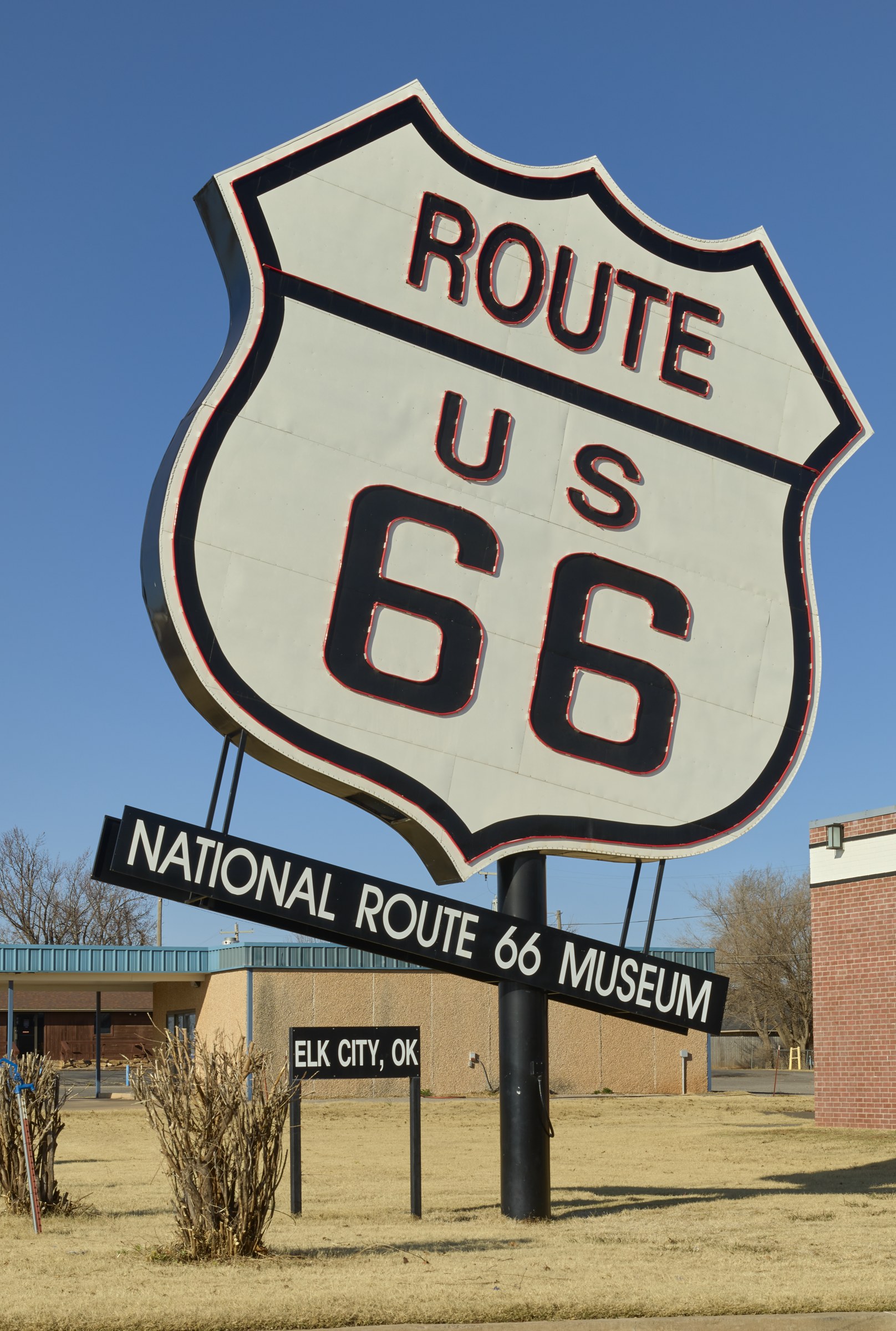 The National Route 66 Museum in Elk City, Oklahoma. Photo: Carol M. Highsmith, Library of Congress.
A road made of other roads
When the federal government started numbering highways in 1926, the country had roughly 2.5 million miles of road, and only about one percent of it was paved. Paved usually meant brick on a downtown street. Everything in between was dirt, gravel, ruts, and the occasional wooden plank.
Route 66 wasn't built from scratch. It was stitched together from roads that already existed: the Old Wire Road out of St. Louis, the Ozark Trail toward Tulsa, the Postal Highway from Oklahoma City to Amarillo, and the National Old Trails Road the rest of the way to Los Angeles. On the day it was born, fewer than 800 of its roughly 2,400 miles were paved.
The number almost wasn't 66
The man behind it was Cyrus Avery, a Tulsa highway commissioner who wanted a Chicago-to-Los Angeles highway running through his hometown. He wanted it numbered 60. Kentucky wanted 60 for its own road, and the compromise offered to Avery was 62, which he took as second best.
On April 30, 1926, Avery met with Missouri's highway engineer at the Colonial Hotel in Springfield, Missouri. Oklahoma's chief engineer, John Page, noticed that 66 hadn't been assigned to anything. They sent a telegram to Washington saying they'd take it. That's why Springfield calls itself the birthplace of Route 66, and why Avery is remembered as its father.
The whole numbered highway system was approved on November 11, 1926, and that date is the road's official birthday. The signs went up the next year. In 1927, boosters in Tulsa formed the U.S. Highway 66 Association with one goal: pave every mile.
The hands that built it
That took twelve years and a lot of muscle.
In the early years, much of the grading was done the way it had been done for decades: horse and mule teams pulling Fresno scrapers, steel scoops that moved about a quarter of a yard of dirt at a time, with wheeled scrapers for the longer hauls. Men worked picks and shovels and drilled holes for blasting powder where rock got in the way. There was no playbook for building a highway for cars. Crews poured concrete in the East, laid asphalt in the West, and learned as they went. The standard pavement width was 18 feet in 1925 and didn't grow to 20 feet until 1930.
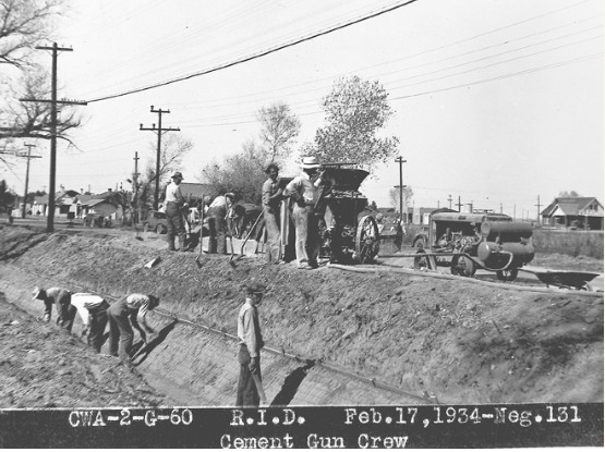 A Civil Works Administration cement gun crew in Arizona, February 17, 1934. New Deal crews like this one built roads, canals and ditches across the West. Courtesy of Arizona State Library, Archives and Public Records and Arizona Memory Project via Mountain West Digital Library.
The Midwest moved fastest. By 1929, Illinois and Kansas were mostly paved, Missouri was about two-thirds done, and Oklahoma about a quarter. Out West it was a different story. Until the Depression hit its worst, Texas, New Mexico, Arizona, and the California desert together had only about 64 miles of surfaced road along the entire route.
Then the Depression supplied the workforce. From 1933 to 1938, the New Deal's Civilian Conservation Corps and Works Progress Administration put thousands of unemployed young men, from nearly every state, onto road gangs along Route 66. Many of them were farm boys whose families had lost everything. In 1938 the road was reported as continuously paved from Chicago to Los Angeles, the first U.S. highway paved end to end (National Park Service).
The work didn't stop when the pavement was down. Highway departments ran maintenance camps along the route, with their own snowplows, graders, and trucks. In January 1930, a storm buried northern Arizona under drifts five feet deep, and the crews out of the Ash Fork camp worked around the clock digging out stranded motorists. They were later commended for saving lives (Clio).
The road had a cost, too. In the West, it was cut across Native American lands, through communities that had no say in where it went. That belongs in the story alongside the rest.
The Mother Road
The timing was remarkable. Route 66 was finished just as two of the biggest migrations in American history needed it.
First came the Dust Bowl families heading west with everything they owned tied to the car. John Steinbeck called it the Mother Road in The Grapes of Wrath in 1939, and the name stuck. Then came World War II. A fully paved, all-weather highway across the Southwest moved troops, equipment, and the workers who staffed the defense plants on the Pacific coast. All that truck traffic beat the road up, and it had to be repaired after the war, just in time for the tourists.
Get your kicks
In 1946, a former Marine and jazz pianist named Bobby Troup and his wife, Cynthia, packed up their 1941 Buick in Pennsylvania and headed to Hollywood so he could try songwriting. Somewhere along the way, Cynthia came up with the title line. By the time they reached California, Bobby had half the song written.
Not long after they arrived, Troup got the song in front of his hero, Nat King Cole. The King Cole Trio recorded "(Get Your Kicks on) Route 66" in Hollywood that March, Capitol released it in April, and it became a hit on both the R&B and pop charts. Bing Crosby, Chuck Berry, the Rolling Stones, and dozens of others have recorded it since.
The song is mostly a roll call of towns along the road. Only one of the eight Route 66 states never gets a mention: Kansas, where the highway ran for just a few miles across the southeast corner. Cynthia later teased her husband for leaving out Albuquerque.
The song, the postwar boom, and a country that finally had cars and gas money turned Route 66 into what we picture now: motor courts, diners, neon, and family-run filling stations in every town along the way.
Bypassed, then brought back
The interstates ended all that. Starting in the 1950s, wider and faster freeways replaced the old road piece by piece and skipped the Main Streets it ran through. Williams, Arizona, fought the hardest. When Interstate 40 finally went around the town on October 13, 1984, Williams was the last town on Route 66 to be bypassed. The town threw a farewell party and brought Bobby Troup in to play the song. The next year, on June 27, 1985, Route 66 was officially removed from the U.S. highway system (National Park Service).
Traffic dried up, and plenty of businesses closed. But the road didn't die. In the late 1980s, people in Arizona, Illinois, and Missouri started Route 66 associations to save what was left. Williams came back in the 1990s when its old railroad to the Grand Canyon was revived. This year, towns from Chicago to Santa Monica are throwing birthday parties.
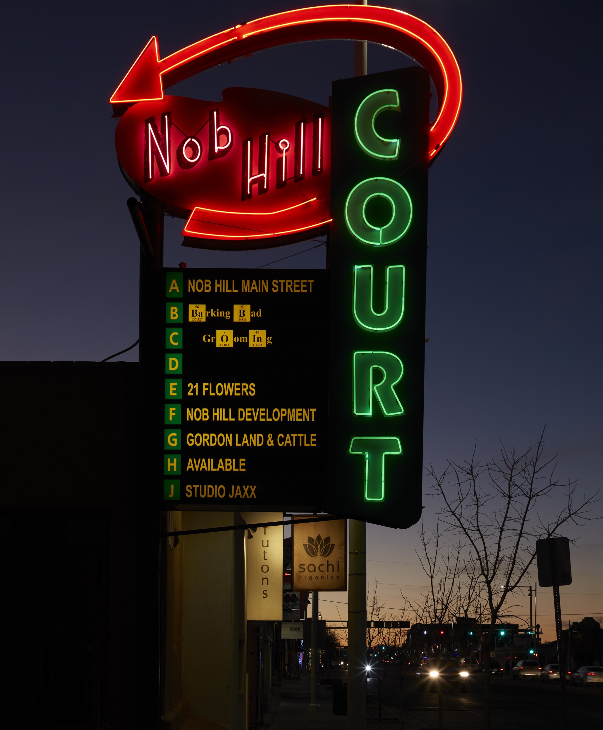 The old Nob Hill Court sign on Central Avenue, Route 66's path through Albuquerque, now lists the small businesses inside. Photo: Carol M. Highsmith, Library of Congress.
Why it matters to us
We talk a lot about infrastructure at Omega, and Route 66 is a good reminder that a road is never just a road. It was built by mule skinners, farm boys on WPA crews, and maintenance men digging cars out of Arizona snowdrifts. The trades that built it are the same ones we're short of today.
And what made the road worth remembering wasn't the pavement. It was the diners, motels, and filling stations, most of them family businesses, that grew up beside it. The interstate made the trip faster, but it skipped the towns. The ones that came back did so because somebody decided the old road and the businesses on it were worth keeping.
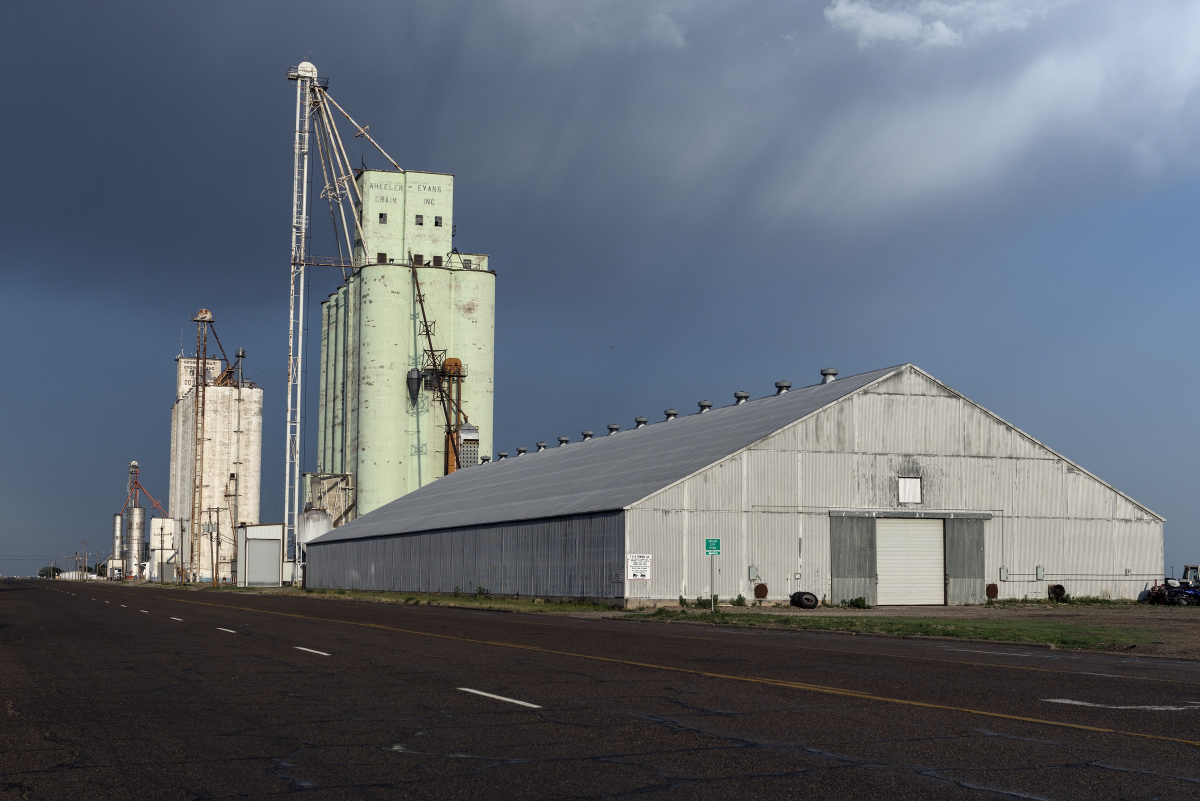 Grain elevators beside the old road, still working. Photo: Carol M. Highsmith, Library of Congress.
Happy 100th birthday, Route 66. Next time you're out West, take the exit, drive through town, and get your kicks.
Sources: National Park Service · Construction Equipment Guide · Springfield, Missouri CVB · History.com · Clio · National Trust for Historic Preservation
Photo: Two lanes of blacktop across the high desert. Carol M. Highsmith, Library of Congress.